Introduction of England's New Coastal Path
A new footpath extending around the entire coast of England is set to be officially inaugurated soon.
At 2,689 miles in length, it stands as the longest managed coastal walking route globally, according to Natural England, the government organization responsible for its creation.
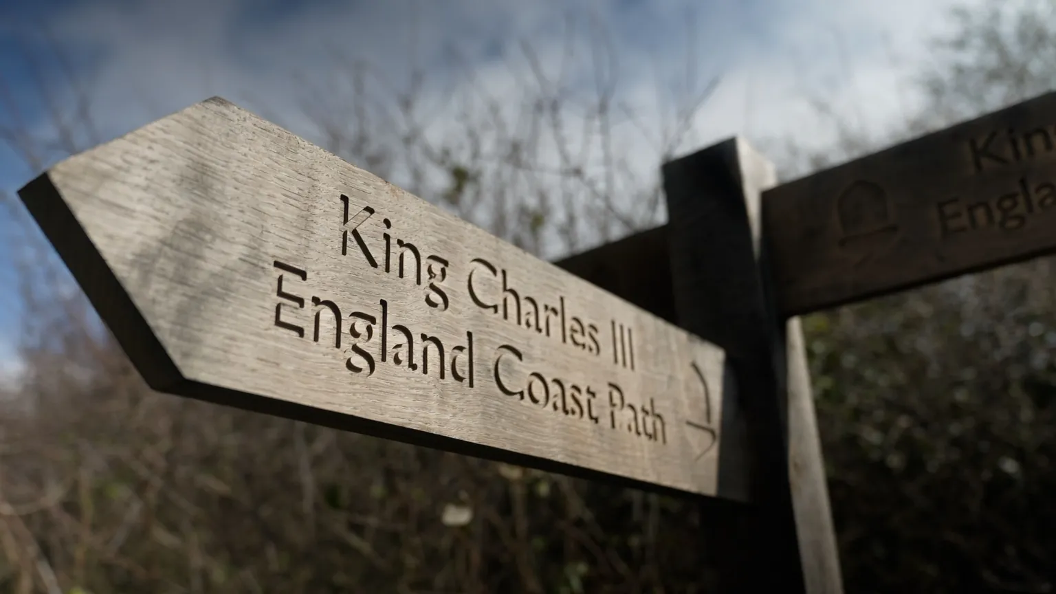
Named the King Charles III England Coast Path, the trail offers, for the first time, a continuous route enabling walkers to explore England's shoreline step by step.
Scenic and Varied Landscapes Along the Route
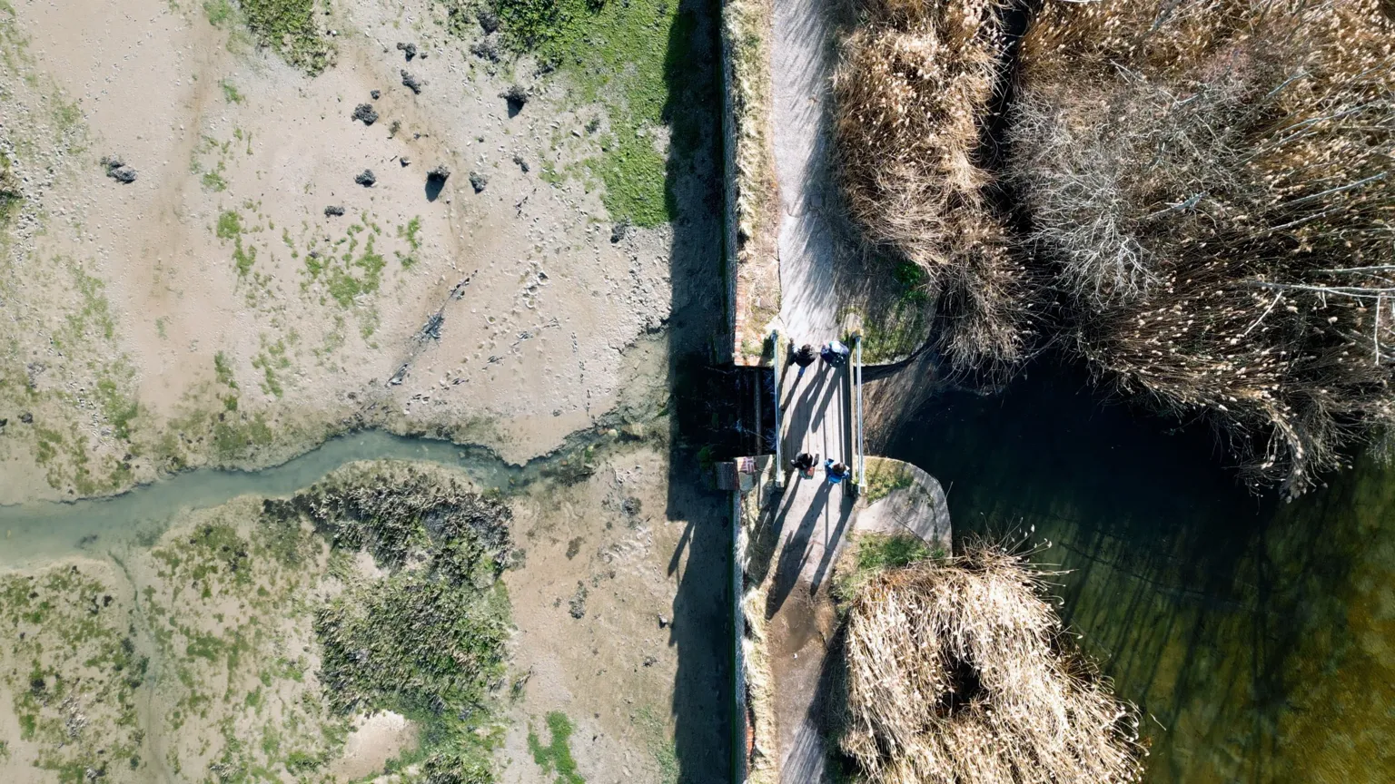
The path traverses some of England's most picturesque and diverse landscapes, including salt marshes, sandy beaches, cliffs, dunes, and historic coastal towns.
One notable highlight is the iconic chalk downland of the Seven Sisters in East Sussex, which is also part of a newly designated National Nature Reserve announced by Natural England.
Development and Enhancements of the Path
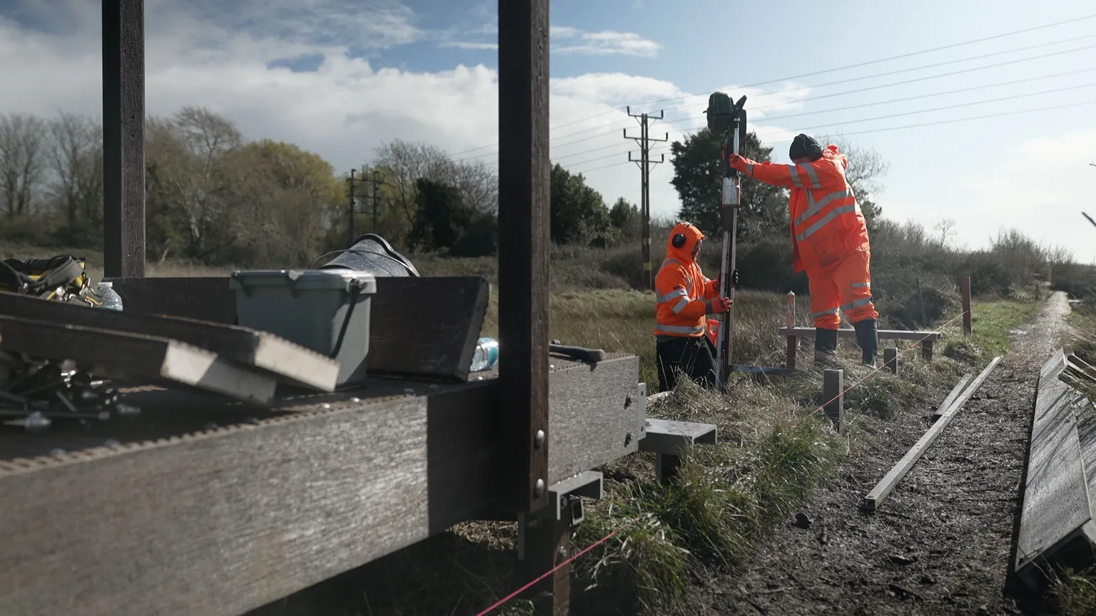
While much of the coastal route previously existed, over 1,000 miles of new paths have been constructed, and numerous sections have been upgraded. Improvements include resurfaced paths, removal of stiles, construction of boardwalks, and installation of bridges.
The initiative began during Gordon Brown's government and has spanned 18 years and seven prime ministers to reach this milestone.
Currently, approximately 80% of the route is open, with the remaining sections expected to be completed by the end of the year.
Significance and Accessibility
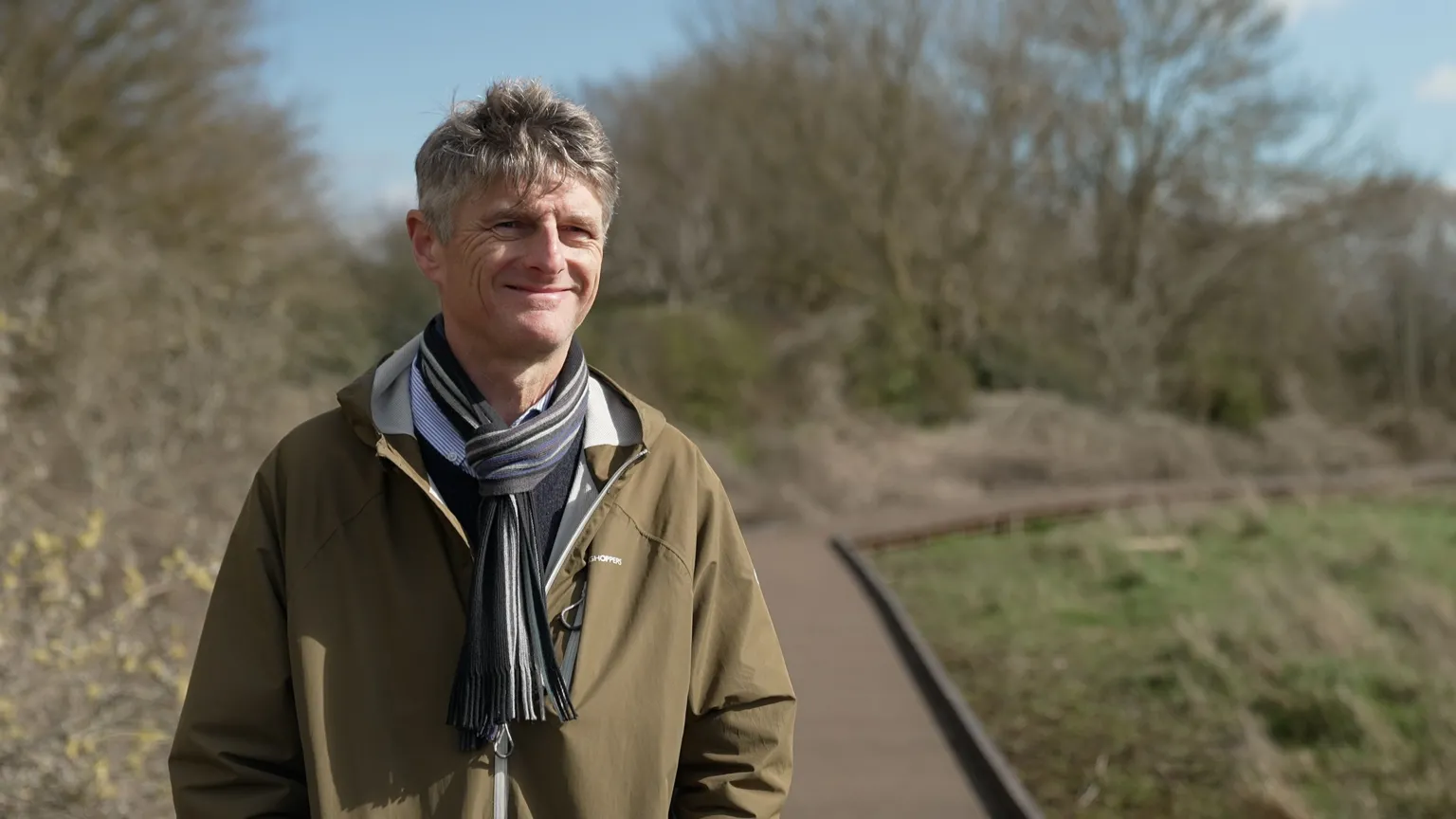
"It is brilliant - the best thing I'll do in my working life,"
said Neil Constable, who led the project for Natural England.
"What makes it so special is that you can walk to the coast anywhere in England, turn left or right, and walk beside the sea for as long as you like."
Establishing the route required new legislation—the Marine and Coastal Access Act, passed in 2009—as well as years of detailed planning and extensive shoreline work to create a clear and continuous footpath.
Natural England reports that in many areas, new access rights have opened land previously inaccessible to the public, including beaches, dunes, and cliff-tops between the path and the sea.
Accessibility improvements have been made for individuals with reduced mobility, enabling more people to enjoy sections of the trail.
Gaps in the existing footpath network have been addressed, focusing on bringing the route closer to the water and connecting stretches of coastline that had never before been linked by a single walking trail.
Challenges Along the Route
In certain locations, walkers must temporarily leave the trail. For example, in north-west England, a ferry crossing over the Mersey is necessary to follow the route.
A particularly challenging section exists in south Devon at the River Erme, where no bridge or ferry is available, and upstream land is privately owned and inaccessible. Walkers are required to wade across the river within an hour either side of low tide.
"It's all part of the experience,"
Constable remarked.

Adaptation to Climate Change
The path has been designed with consideration for increased rainfall and rising sea levels expected due to climate change.
For the first time in English law, there is provision for the route to be moved inland—referred to as "rolled back" by Natural England—if coastal erosion or shifts occur.
This flexibility allows the trail to adapt to changing shorelines, aiming to maintain continuity and practicality for future generations.
Recent Events Demonstrating Path Dynamics
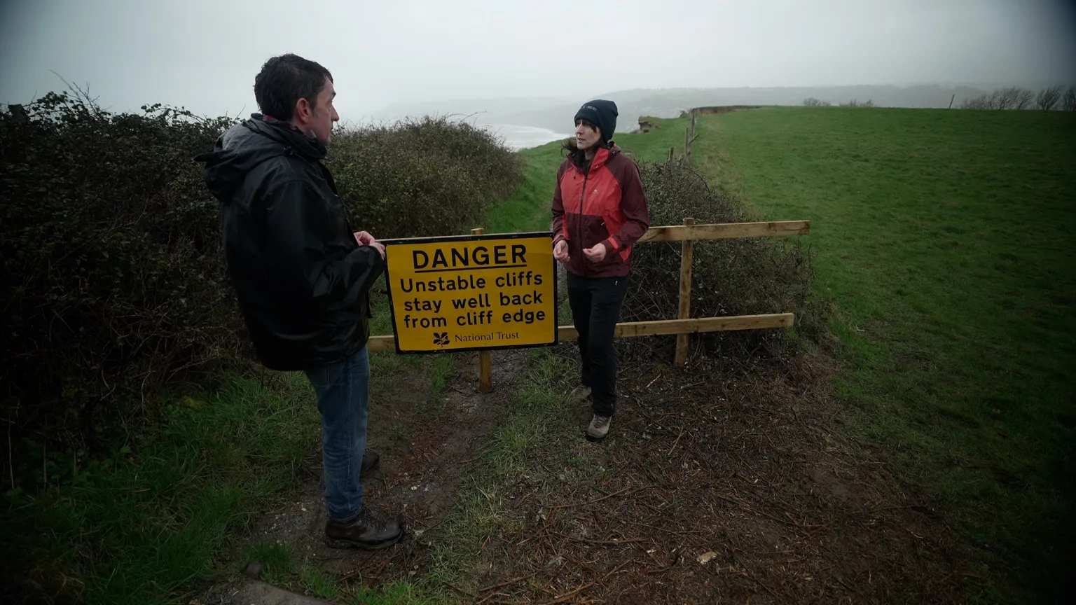
Recent weeks have illustrated the route's dynamic nature. In early February, a large section of the path on cliffs outside Charmouth in Dorset was lost following heavy winter rains that caused a landslip.
"The path was closed and a diversion was put in place,"
explained Lorna Sherriff, who leads the team managing the South West Coast Path—the longest and most challenging section of the new trail.
The diversion added an extra mile and a half and required walkers to use roads. Sherriff noted that her team quickly arranged a 15-metre rollback with the landowner, allowing the path to reopen within weeks.
"Without this rollback provision in place that would have taken us months,"
she said.
Support from The Ramblers Charity
The Ramblers charity has advocated for greater access to England's coastline since the end of World War II. Jack Cornish, director of England for the Ramblers, described the new path as "transformational."
"It creates a band of access land from the trail to the high water mark, so that means you can leave the trail to go and roam the beaches,"
Cornish explained.
"You can picnic - and on an island nation you can really enjoy our coast for the first time."
Linking Coastal Paths Across Britain
The route also opens the possibility of a continuous coastal walk around the entire island of Britain.
The new English coast path connects with the Wales Coast Path—an 870-mile route encircling the Welsh coastline, completed in 2012 as the first path worldwide to follow an entire national coastline.
Scotland does not have a single official coastal trail, but much of its shoreline is accessible due to the "right to roam" law enacted over 20 years ago. Estimates of Scotland's mainland coastline vary but are often cited at approximately 5,500 miles.
Combined, a continuous coastal walk around Britain would total about 9,000 miles. At an average of 15 miles per day, completing the journey would take nearly two years without rest days.
Accessing the Path
Those interested in walking some or all of the King Charles III England Coast Path can find route maps on the National Trails website.
for the Future Earth newsletter to stay informed about the latest climate and environment stories with the BBC's Justin Rowlatt. International readers can to the international newsletter.