
Preparations Underway as Super Typhoon Bavi Approaches
Rain has begun falling in Saipan, Northern Mariana Islands, as super typhoon Bavi approaches the US Pacific territories, prompting emergency evacuations in Guam and the Northern Mariana Islands.
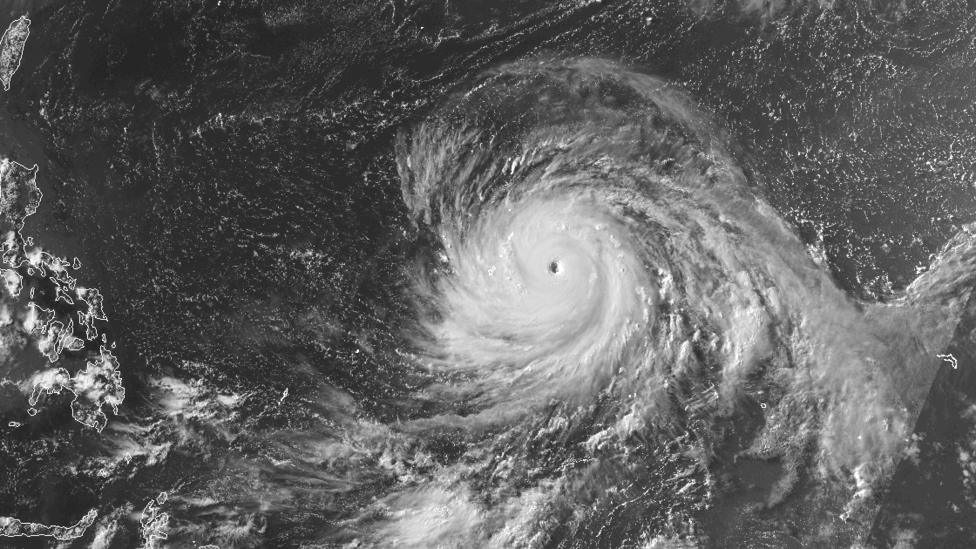
Bavi is forecast to make landfall early Monday morning, bringing winds of up to 257 km/h (160 mph), according to the US National Weather Service (NWS).
The NWS has issued warnings describing the storm as "very dangerous" with potential for "catastrophic" damage. Significant flooding from torrential rains is possible, and waves could reach nearly 11 meters (35 feet) high on Monday.
The western Pacific region is known for frequent tropical cyclones, but storms of Bavi's intensity are uncommon for these US islands.
Bavi is expected to pass directly over Guam and the Northern Mariana Islands by Monday afternoon. The NWS cautioned that destructive conditions could be experienced eight to ten hours before the storm's center arrives.
"The window is rapidly closing to evacuate if directed to do so by local officials, or if your home is vulnerable to high winds or flooding,"the agency stated, adding that winds
"will pose a deadly threat to those venturing outside".
Guam, typically a sun-soaked tourist destination with a population of about 170,000, has opened five evacuation centers located in schools. These centers have a combined capacity of approximately 1,700 people and are primarily intended for vulnerable residents.
At 13:00 local time (03:00 GMT) on Sunday, the island's civil defense office reported that one evacuation site had reached full capacity and that evacuees were being redirected to other locations.
Classification and Expected Impact of Typhoon Bavi
Bavi has been classified as a super typhoon by the Joint Typhoon Warning Center (JTWC), a US Navy agency responsible for monitoring tropical storms in the western Pacific.
A super typhoon is defined as having winds exceeding 130 knots (150 mph). The JTWC predicts Bavi will have sustained winds of 150 knots (173 mph) upon arrival over the islands, with gusts up to 180 knots (207 mph).
The NWS equates super typhoons to category four or five hurricanes in terms of destructive potential.
Local Reactions and Preparations
Pinky Cubacub, 55, shared her concerns with news agency AFP while boarding up the windows of her eatery in Guam using $500 (£373) worth of plywood.
"I cannot afford to lose so many days. It hurts,"she said.
"Because I just started, whatever we're making right now is just for rent, utilities, and my people, and supplies. I don't even pay myself yet."

Japanese tourist Miku Sakurai, 25, told AFP that her return flight to Tokyo scheduled for Sunday had been cancelled.
"We will stay in the hotel when the storm comes. I am scared,"she said.
Climate Context and Historical Impact
The western Pacific regularly experiences powerful typhoons, but scientists indicate that climate change is increasing their frequency and intensity.
Bavi will be the 11th category four or five tropical cyclone to hit US territory in the past decade, surpassing the total of such storms recorded in the previous 57 years.
A strong El Niño event, characterized by periodic warming of surface waters in the Pacific, is expected to contribute to more tropical storms reaching higher intensities.
Guam and the Northern Mariana Islands have already been impacted by one super typhoon this year: Sinlaku in April, which resulted in 17 fatalities and approximately $1.5 billion (£1.1 billion) in damages.
Warmer sea surface temperatures increase atmospheric moisture, intensifying storms.


