

Strong Winds and Travel Disruption Expected Across the UK
Travel disruptions are anticipated over the coming days as winds strengthen across the United Kingdom. The Met Office has issued yellow weather warnings due to expected wind gusts reaching up to 70mph (113km/h) around coastal areas of the Irish Sea on Thursday.
These strong winds will be widespread throughout the day for most regions. Following this, temperatures are forecast to drop on Friday, bringing a return of wintry conditions including snow on higher ground.
On Wednesday morning, gusts exceeding 70mph (113km/h) were recorded in northern and western Scotland as a deep low-pressure system passed north of the UK. Although the strongest winds have begun to ease and a Met Office yellow warning expired at midday, minor travel disruptions may persist into the afternoon. These include cancelled ferries, flight delays, and bridge restrictions affecting high-sided vehicles.
Wednesday will generally be dry and bright for much of the UK, with frequent showers expected across Scotland.
New yellow severe weather warnings have been issued for Thursday by the Met Office. The first warning takes effect at 05:00 GMT and covers North Wales, northern England, and southern and eastern Scotland, remaining valid until 20:00 GMT. Winds will intensify as an area of heavy rain moves southeastward. Widespread gusts of 50-55mph (65-89km/h) are expected, with coastal and hilly areas potentially experiencing gusts up to 60mph (97km/h) or even 70mph (113km/h).

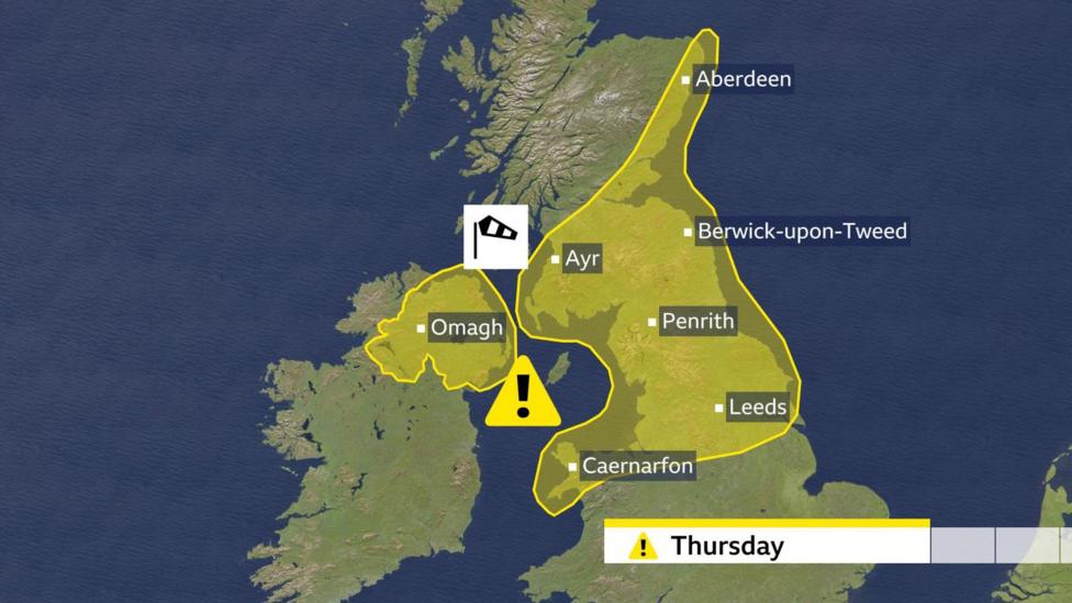
Additionally, a separate yellow warning has been issued for the entirety of Northern Ireland, valid from 06:00 to 12:00 GMT. During this period, gusts may reach 60mph (97km/h) accompanied by heavy rain, with winds easing from the west later in the morning.
Travel disruptions on Thursday are anticipated due to the strong winds, including bridge restrictions and possible delays on ferry and rail services.
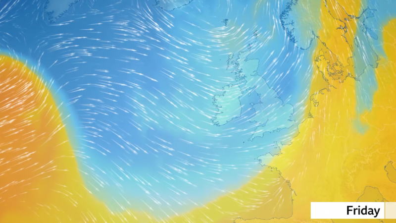
Looking ahead to the weekend, another deep low-pressure system will pass south of Iceland, bringing strong winds on its southern flank across the UK. These northwesterly winds will usher in colder air from the Arctic region on Friday.
Wintry Weather and Snow Forecast for Later in the Week
On Friday, northwesterly winds will draw colder Arctic air into the UK. Temperatures are expected to fall to approximately three or four degrees below average. Combined with strong winds, this will likely result in a significantly colder feel.
Fast-moving hail showers may occur across much of the country, with brief wet snow flurries possible even in southern areas, though snow accumulation there is unlikely. Most accumulating snow is expected on mountains and higher ground in Scotland, Northern Ireland, and northern England, with some potential for snow in Wales and southwest England.
There is also a possibility of further wintry showers on Sunday.
Additional Information
- Wet winter leads to 'extremely frustrating' grassroots football season
- UK winter not a record breaker despite floods and storms


