

Starting Point and Trail Overview
The tradition at the beginning of the Coast to Coast walk is to dip your boots in the sea near the village of St Bees.
This location, situated on the Irish Sea coast in West Cumbria, marks the start of a lengthy journey all the way to the North Sea.
The trail spans 190 miles (305 km) across three National Parks, extending from England's west coast to its east.
"It's got culture, it's got historical interest and it's got challenge, but it isn't too challenging," says Doug Sim, chair of St Bees Parish Council. "And by having a definitive start and finish at the beaches, it feels very complete."
The route has recently been designated England's newest National Trail following a £5.5 million upgrade. This project, led by Natural England and its partners, enhanced surfacing, signage, and accessibility along the path.

Origins and Historical Significance
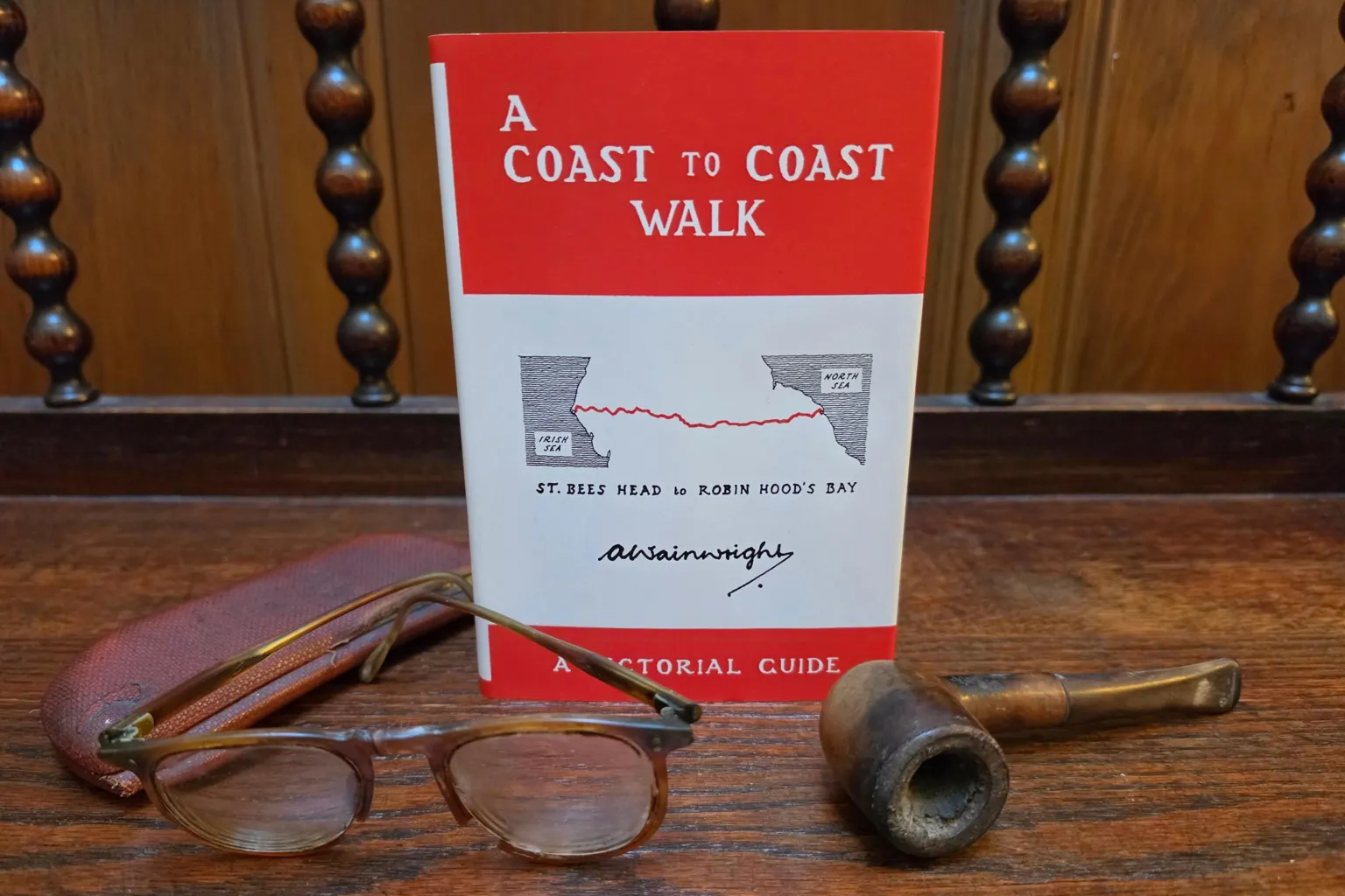
The Coast to Coast was originally devised and walked by the renowned fell-walker Alfred Wainwright more than 50 years ago.
Wainwright believed that the Pennine Way—a famous 268 mile (429 km) trail from the Peak District to the Scottish Borders—was too long for most walkers, requiring three weeks to complete. He envisioned a challenging yet scenic two-week trek instead.
In the early 1970s, Wainwright published a guidebook to the Coast to Coast, handwritten and illustrated with his sketches, which remains a celebrated work of art.
I personally walked the trail in 1991, carrying the guidebook. The weather was excellent, and I was fortunate to experience ideal conditions.
Trail Difficulty and Route Details
The initial days through the Lake District are the most demanding, involving ascents and descents over multiple mountain ridges and remote valleys.
Reaching the village of Shap signifies completion of the most challenging section.
Previously, parts of the route crossed permissive paths on private land, which could be closed during certain times of the year.
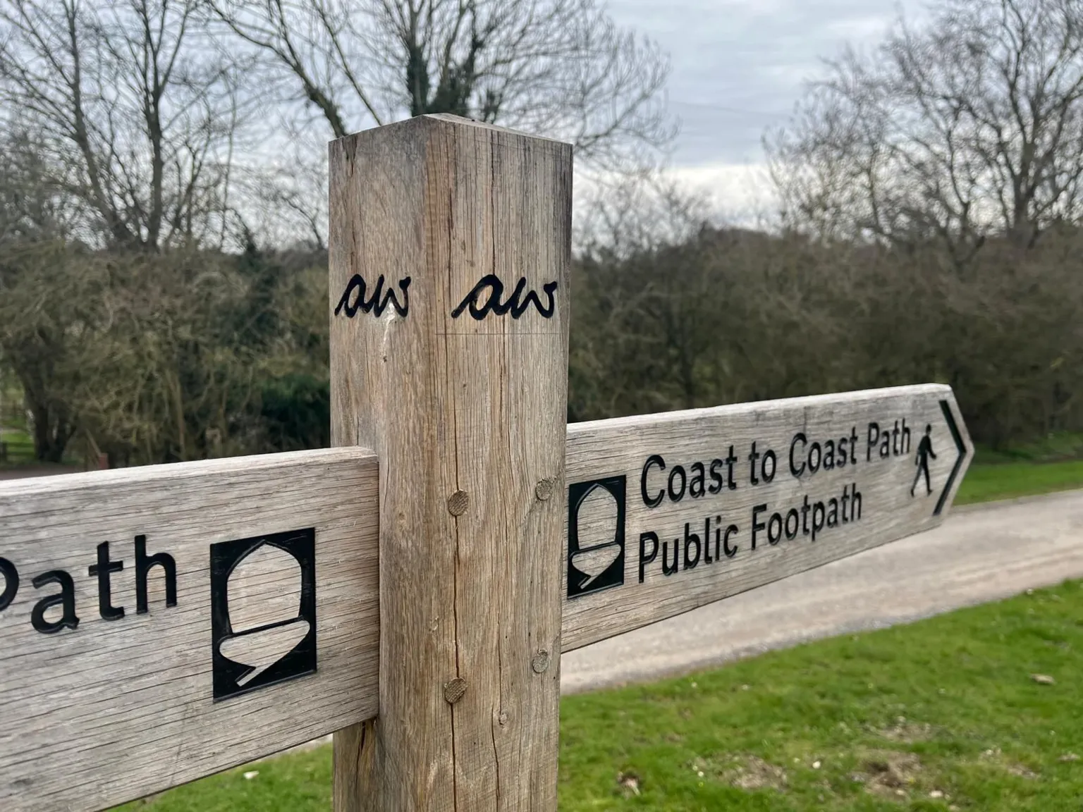
In recent years, extensive legal efforts by local authorities and National Parks have secured official rights of way, ensuring year-round access.

Signage has also been improved, with way-markers now featuring the letters "aw" as a tribute to Alfred Wainwright, the trail’s originator.
Accessibility Enhancements
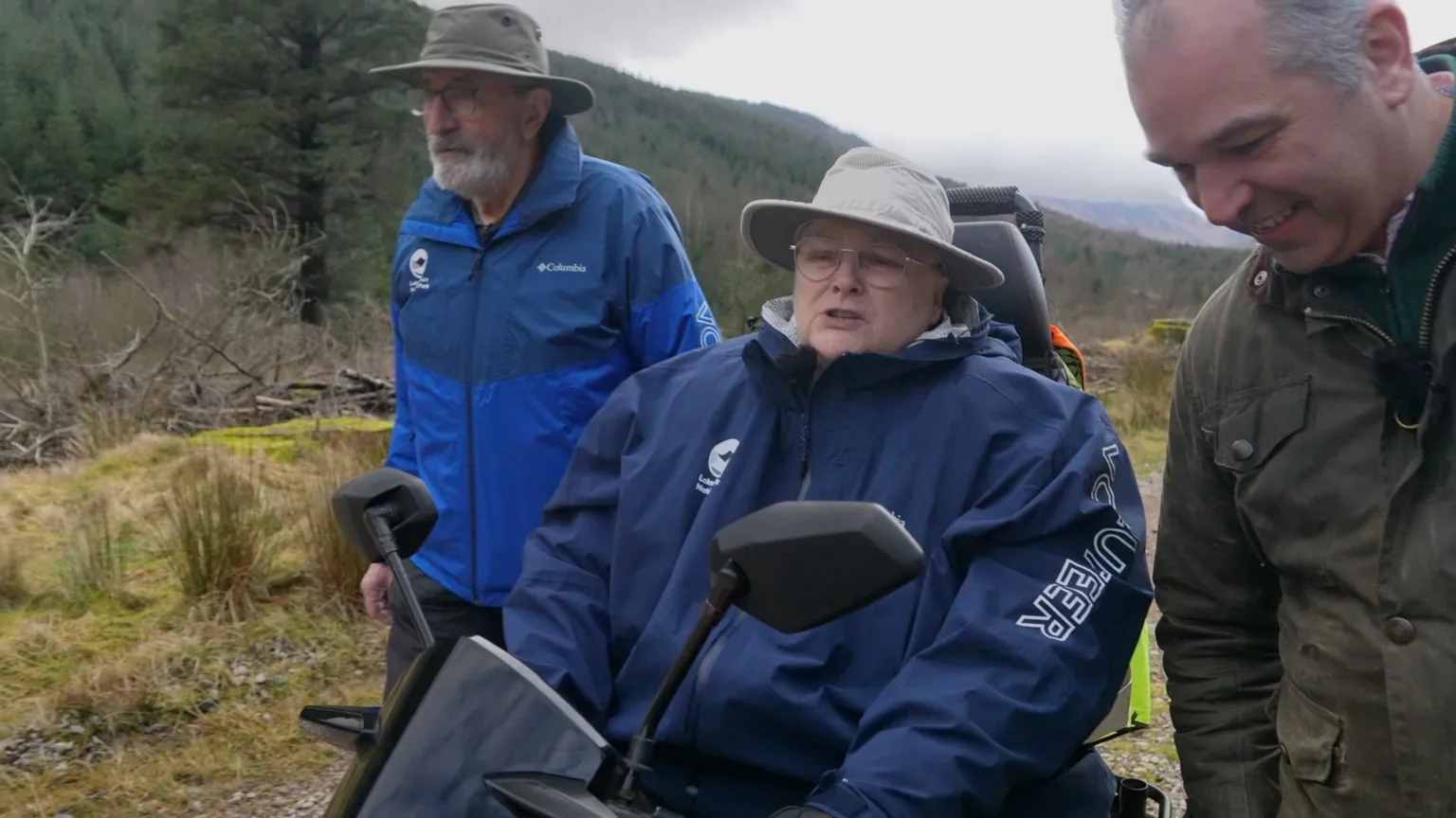
On the second day, most walkers proceed eastward up Ennerdale in the Lake District, an area that has seen significant improvements including new gates and bridges to enhance accessibility.
While it remains impossible for wheelchair users to traverse the entire trail, many sections are now accessible. This development is particularly meaningful for Annie Wallen, a local resident who uses a motorised wheelchair and can travel up to 15 miles (24 km).
She says Wainwright "might have walked in boots but I roll on rubber. I love it." Being able to complete parts of the trail is "really special" to her.
Above the valley, the path extends over high ground where large flagstones have been installed to prevent erosion caused by decades of foot traffic from visitors worldwide.
Jo Willmott, a project ranger for the trail's upgrade, notes, "You often meet people from the US, Canada and other countries. It's showing the best of the UK."
Yorkshire Dales and Local Insights
After the Lake District, the trail continues through the Yorkshire Dales National Park.
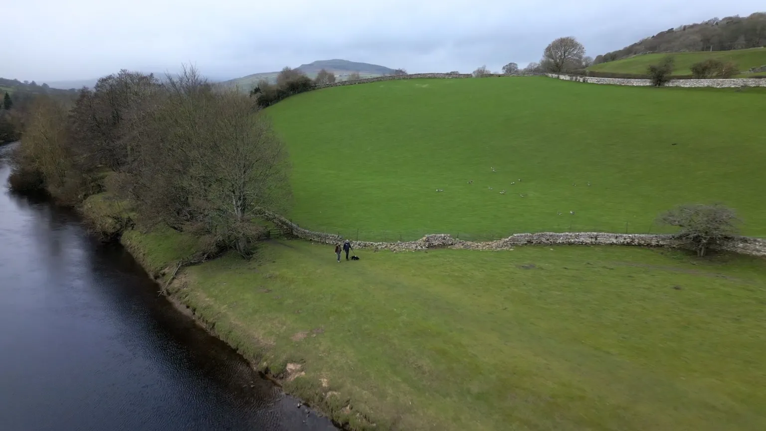
The route passes from Kirkby Stephen over hills to Swaledale, past the ruins of old lead mines recently featured in the adaptation of Wuthering Heights, and through lush pastures to the villages of Reeth and Richmond.
This section is favored by Mark Reid, who has completed the Coast to Coast nine times and guides groups along the entire trail.
I met Mark on the village green in Reeth and accompanied him to the banks of the River Swale.
He says, "you've got a group of friends" after two weeks of walking, and visitors often return repeatedly. "You reach the North Sea and it's really emotional, there are people in tears. It's really quite a fantastic experience."
The frequent returns by walkers contributed to the decision to invest £5.5 million in upgrading the trail, seen as an investment with clear future returns from visitor spending.
Final Stretch to the North Sea
From the Dales, the Coast to Coast proceeds to the North York Moors National Park.
In late summer, the moorland path is adorned with flowering purple heather. The route passes the iconic Lion Inn pub at Blakey Ridge, traverses wooded gorges, passes steam trains at Grosmont, and culminates at Robin Hood's Bay.
The finish is picturesque: a quiet, steep lane descends through fishermen's cottages with their distinctive orange pantile roofs to a waterside hotel and the sea, or to rock pools when the tide is out.
This is the location where walkers can dip their boots in the water for the final time and reflect on their journey.


