

Using Satellite Data and AI to Monitor Hedgehogs
Researchers at the University of Cambridge are employing satellite data combined with artificial intelligence (AI) to address the decline of Britain's hedgehog population.
They utilize an AI tool named Tessera, which analyzes high-resolution images of the UK captured from space, enabling experts to accurately identify hedgehog habitats and detect areas where these habitats are diminishing.
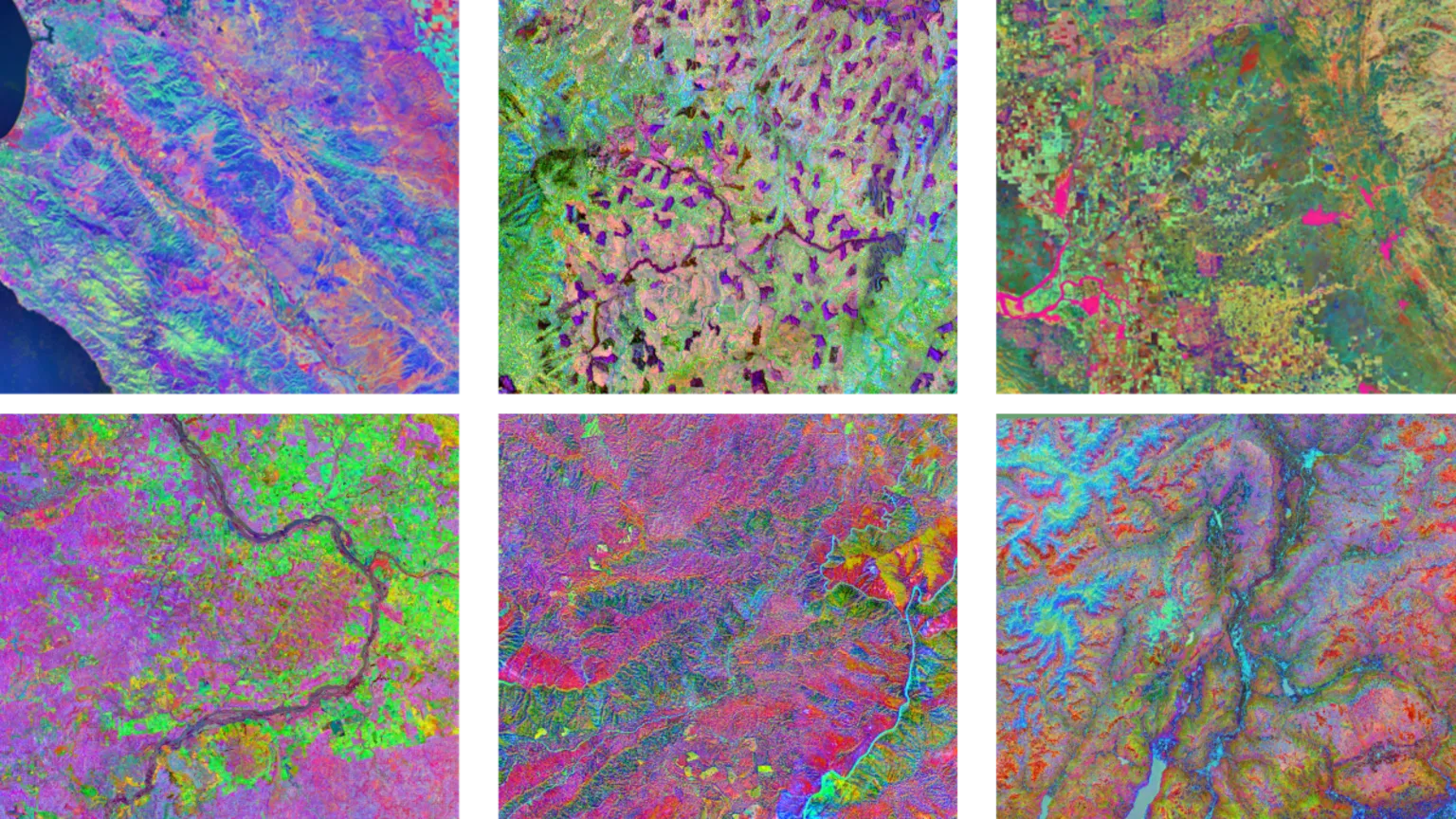
The maps generated by Tessera detail landscapes with exceptional precision, including individual hedgerows, while the AI can predict hedgehog-friendly locations even when obscured by cloud cover.
The project aims to illuminate not only where hedgehogs reside across the UK but also the obstacles that hinder their access to food and mates.
Researchers indicate that Tessera's outputs can monitor the effects of new housing developments and other environmental changes on landscapes potentially impacting hedgehogs over time.
These insights can be integrated with additional data sources, such as GPS trackers attached to some hedgehogs to observe their movements in real time.
A similar initiative involving "backpack"-style trackers to protect hedgehogs is already in progress in Northern Ireland.
Meanwhile, scientists are increasingly exploring AI systems and models capable of processing extensive datasets to reveal patterns that support conservation efforts globally.
However, some experts urge caution regarding the environmental impact of such energy-intensive technologies.
'Digi-hogs' and Population Decline
Hedgehog populations have experienced significant declines across Europe in recent decades.
In the UK, a 2022 report estimated that rural hedgehog numbers have fallen by up to 75% since 2000.
The common western European hedgehog, the UK's only native species as noted by the RSPCA, is classified as 'Near Threatened' by the International Union for the Conservation of Nature.
Prof Silviu Petrovan, strategy and research manager at People's Trust for Endangered Species, expressed optimism about AI's potential to aid in protecting these small mammals.
"What we're really hoping is that we can use these really powerful models to understand, for instance, what are the very specific barriers for hedgehogs to find food and find their mates, and be able to safely move around the countryside?"
He told the BBC that researchers involved in the project refer to hedgehogs equipped with trackers as "digi-hogs."
To accurately identify hedgehogs and other objects within image data, the Tessera system was trained on an extensive dataset—approximately 20 petabytes, equivalent to 10 billion standard digital photos.
After reaching the limits of the university's allocated computing power, researchers installed additional processors beneath their desks to continue the training process.
A new partnership with US technology companies AMD and Vultr has also provided access to further computational infrastructure.
The expansive, open-source Tessera system is not limited to hedgehog monitoring.
Anil Madhavapeddy, professor of planetary computing at Cambridge University, told the BBC that over 100 research groups have utilized the tool.
The system can also monitor farmland, tracking crop types across fields over time to build a comprehensive picture of UK agriculture.
"Satellite data is really complicated to use and really noisy, because you have to do things like cloud removal and adjust for day and night, and so on,"
"Tessera compresses loads of that data and gives us really easy-to-use maps of the UK, where we can ask really specific questions about things we can see from space."

for our Tech Decoded newsletter to follow the world's top tech stories and trends. Outside the UK? here.


