

What are El Niño and La Niña?
El Niño and La Niña represent the two opposing phases of a natural climate phenomenon known as the El Niño Southern Oscillation (ENSO). These phenomena originate in the Pacific Ocean but have far-reaching effects on weather systems worldwide.
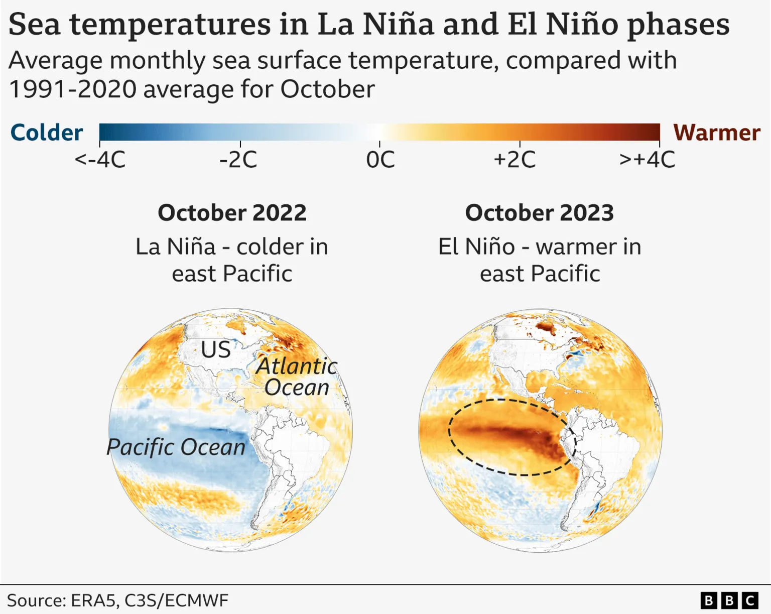
The identification of El Niño and La Niña is primarily based on sea surface temperatures in the tropical eastern and central Pacific Ocean. El Niño is characterized by warmer-than-average waters, whereas La Niña features cooler-than-average waters in these regions.
Atmospheric pressure patterns also distinguish these phases. During El Niño, pressure tends to be higher than normal at Darwin, Australia (western Pacific), and lower than normal at Tahiti, French Polynesia (central Pacific). La Niña exhibits the opposite pattern.
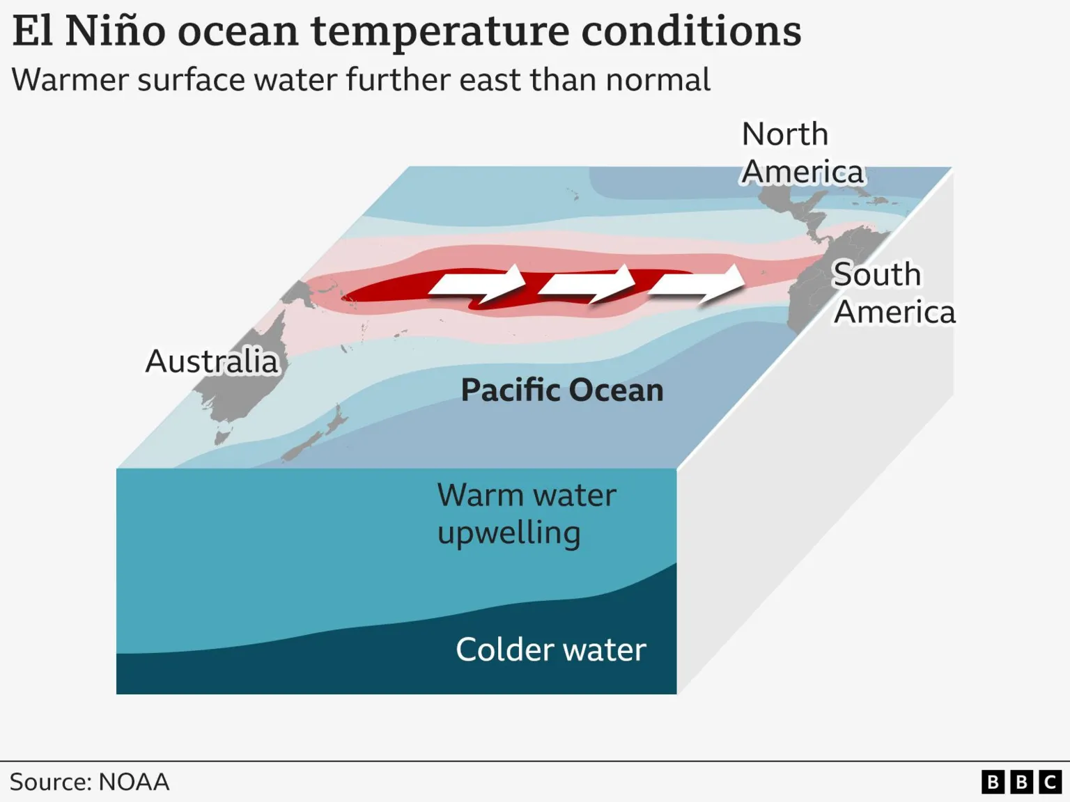
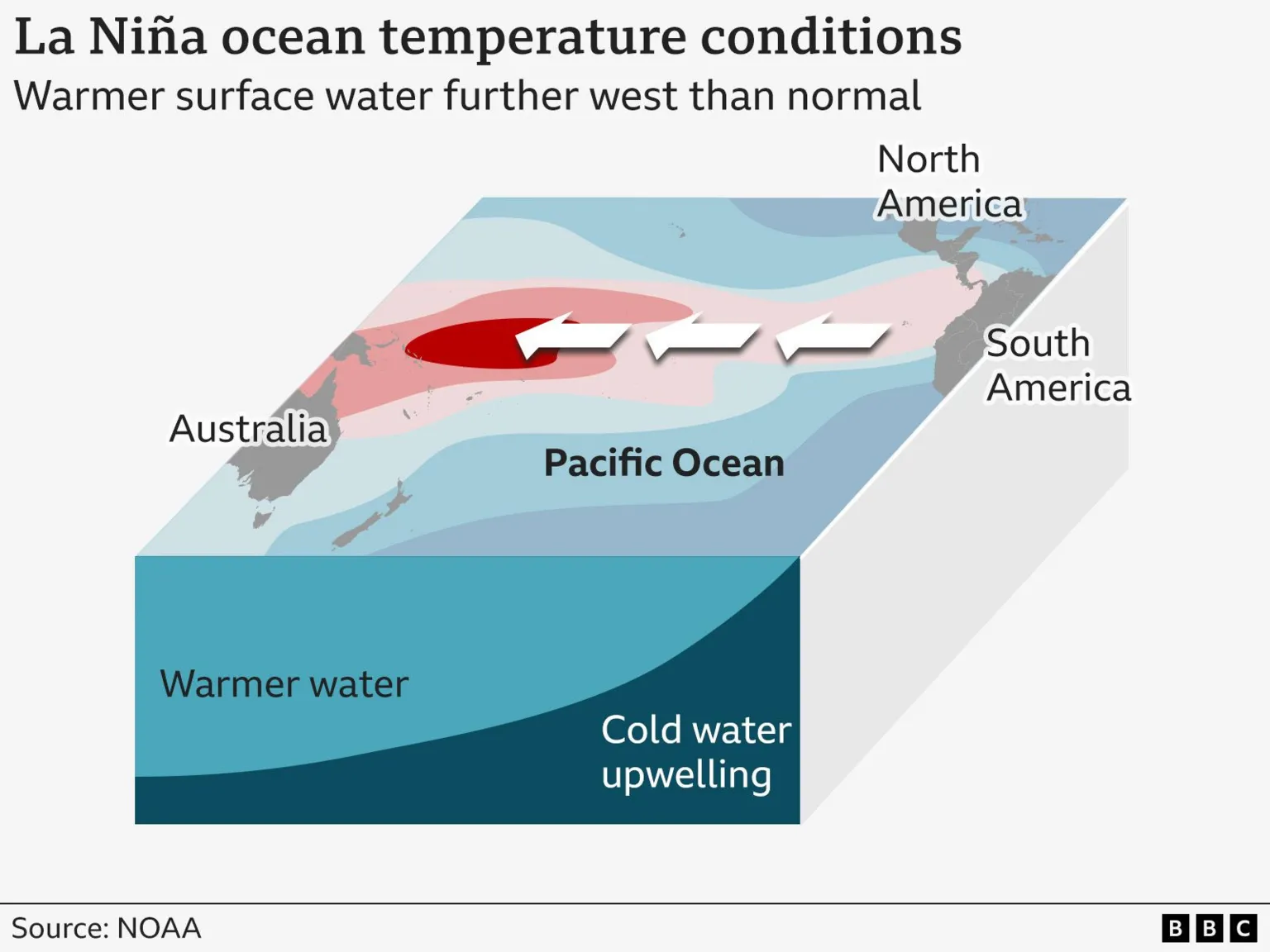
When conditions are neutral—neither El Niño nor La Niña—the surface water in the Pacific Ocean is cooler in the east and warmer in the west. Trade winds typically blow from east to west, warming the waters progressively as they move westward.
During El Niño events, these trade winds weaken or reverse, causing warm surface waters to shift eastward. Conversely, La Niña periods see stronger-than-usual east-to-west winds, pushing warmer waters further west. This intensifies the upwelling of cold water from the ocean depths, resulting in cooler sea surface temperatures in the eastern Pacific.
The phenomenon was first noted by Peruvian fishermen in the 1600s, who observed warm waters peaking near the Americas in December. They named it "El Niño de Navidad," meaning Christ Child in Spanish.
How do El Niño and La Niña change the weather and environment?
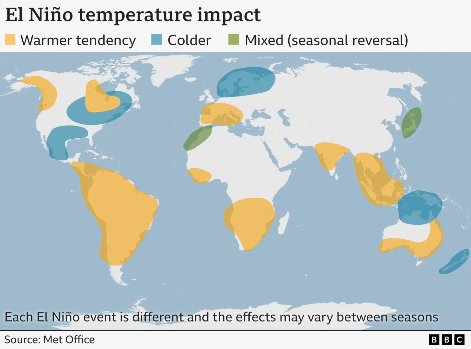
The impacts of El Niño and La Niña vary by region and time of year, with no two events being identical. However, certain general patterns have been observed by scientists.
Globally, temperatures tend to rise during El Niño and fall during La Niña. El Niño causes warmer water to spread further and remain closer to the surface, releasing more heat into the atmosphere and generating wetter and warmer air.
Regional effects are complex; some areas may experience both warmer and cooler conditions at different times within the same year. The year 2024, the hottest on record, was influenced by El Niño conditions combined with ongoing human-induced climate change.
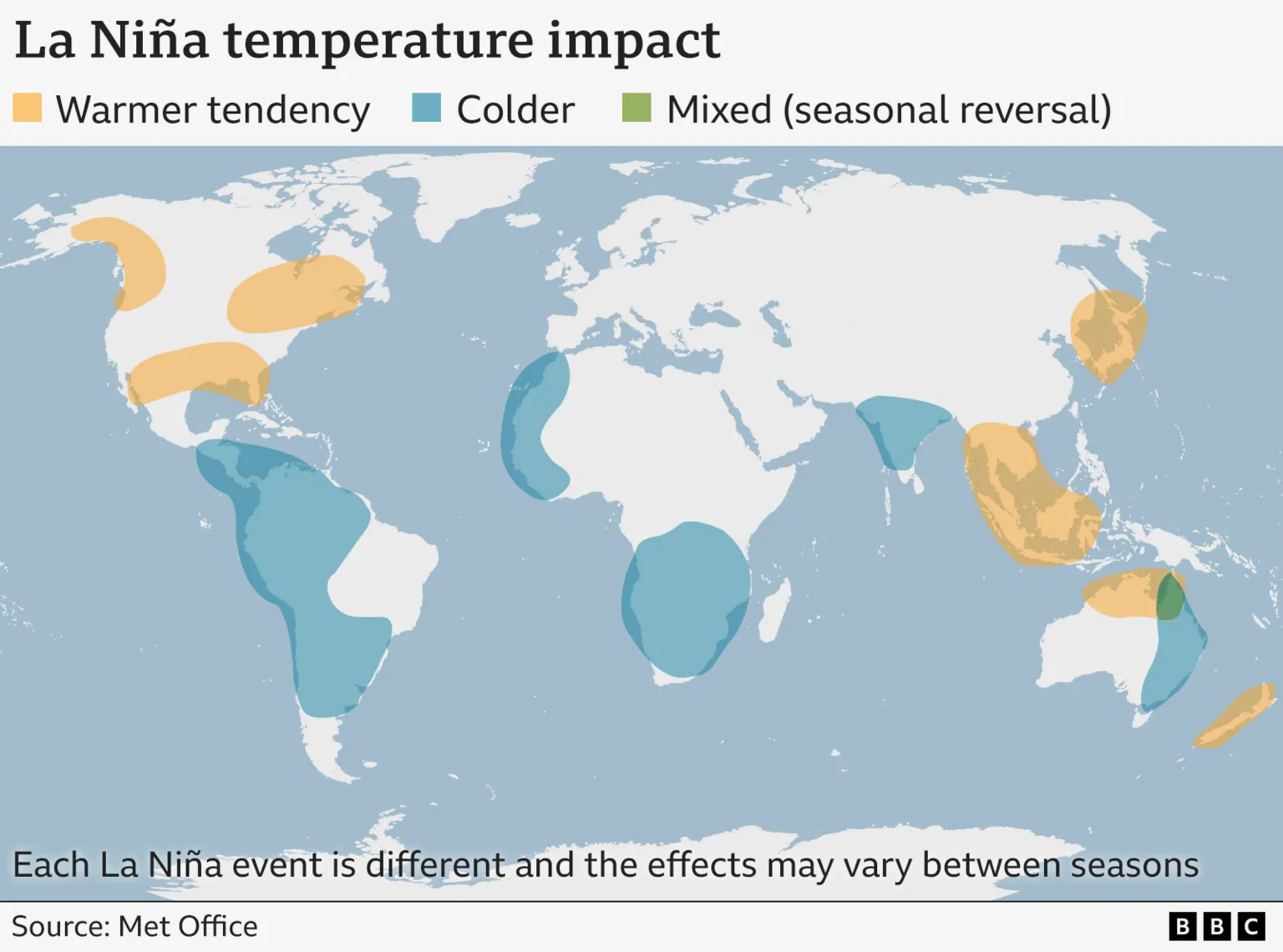
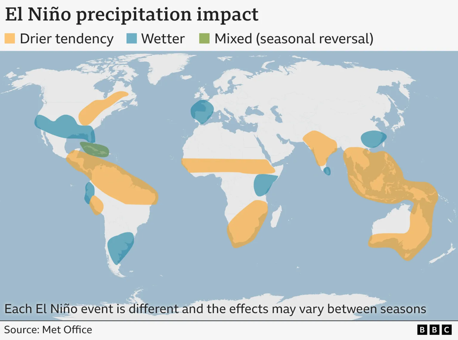
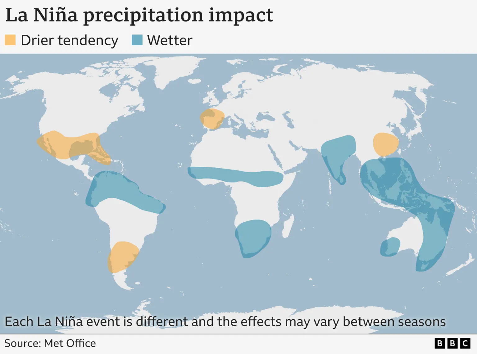
The following maps illustrate typical effects, though these patterns may only apply during certain periods.
The influence of these systems on UK temperatures is intricate and variable. According to the Met Office, El Niño may increase the likelihood of a mild start and a cold end to the UK winter, whereas La Niña tends to favor a colder start and a milder end to the season.
During El Niño, the warmer ocean waters shift the Pacific jet stream's strong air currents southward and eastward, bringing wetter weather to the southern United States and the Gulf of Mexico. Tropical regions such as Southeast Asia, Australia, and central Africa generally experience drier conditions.

La Niña typically results in wetter conditions across parts of Australia, Indonesia, and equatorial South America, while the southern United States tends to be drier.
El Niño usually increases the number of tropical storms in the tropical Pacific but decreases them in the tropical Atlantic, including the southeastern United States. La Niña generally produces the opposite effect.
Scientists have also noted that atmospheric CO2 levels tend to rise during El Niño events, possibly due to warmer and drier conditions in tropical regions. Reduced plant growth during droughts leads to less CO2 absorption, while increased wildfires, such as those in South Asia, release additional CO2.
Why do the El Niño and La Niña climate patterns matter?
The extreme weather events intensified by El Niño and La Niña have significant impacts on infrastructure, food security, and energy systems worldwide.
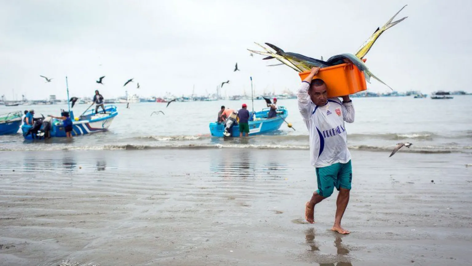
For instance, during El Niño events, the reduction of cold water upwelling off the west coast of South America limits the rise of nutrients from the ocean depths. This diminishes food availability for marine species such as squid and salmon, adversely affecting South American fishing communities.
The 2015-16 El Niño event caused droughts and flooding that impacted the food security of more than 60 million people, according to the UN Food and Agricultural Organisation.
Research has also shown that El Niño episodes can negatively affect global economic growth.
How often do El Niño and La Niña episodes happen?
El Niño and La Niña episodes typically occur every two to seven years. They usually last between nine and twelve months but can persist longer and do not necessarily alternate in sequence.
The current La Niña episode began in mid-to-late 2024.
Is climate change affecting El Niño/La Niña?
In 2021, the Intergovernmental Panel on Climate Change (IPCC) reported that ENSO episodes since 1950 have been stronger than those observed between 1850 and 1950. However, historical data such as tree rings indicate variations in the frequency and intensity of these episodes dating back to the 1400s.
The IPCC concluded that there is no definitive evidence linking climate change to alterations in ENSO events.
Some climate models suggest that global warming could lead to more frequent and intense El Niño episodes, with greater variability between El Niño and La Niña phases. Nevertheless, this remains a complex and uncertain area of research without clear consensus.
"The ENSO episodes that have occurred since 1950 are stronger than those observed between 1850 and 1950," the IPCC stated in 2021.
Additional reporting by the Visual Journalism team.


