

Alaska Megatsunami: A Massive Wave from Mountain Collapse
A massive 'megatsunami' wave generated when a section of an Alaskan mountain collapsed into the sea ranks as the second tallest ever recorded. Scientists emphasize that this event highlights the dangers linked to melting glaciers.
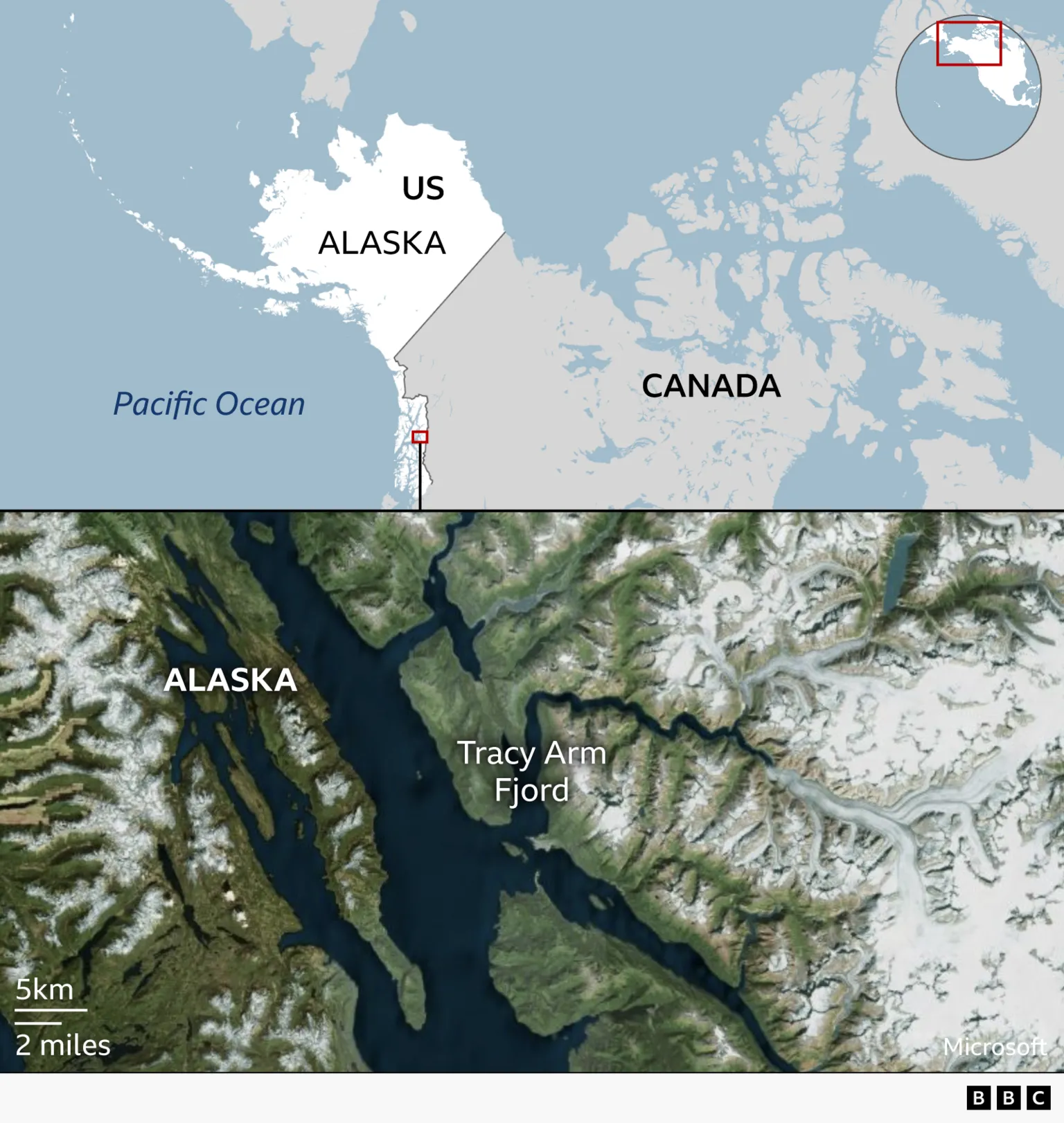
Last summer, a colossal wave surged through a remote fjord in southeast Alaska, causing extensive destruction.
The incident received little attention initially, but recent scientific analysis reveals that minor earthquakes triggered a substantial landslide.
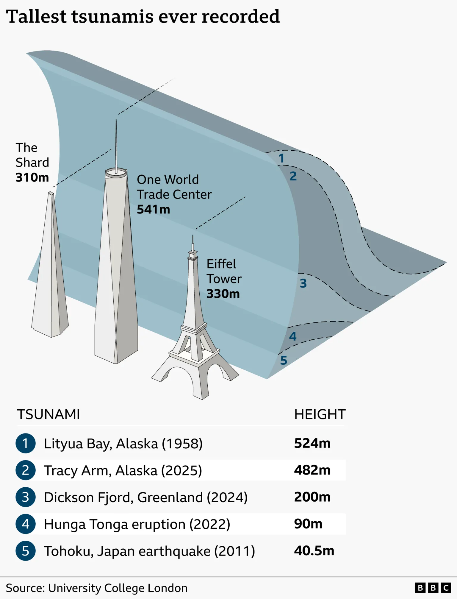
An astounding 64 million cubic metres of rock—equivalent to 24 Great Pyramids—plunged into the water below. The immense force of this volume of rock entering the fjord in under a minute produced a gigantic wave nearly 500 metres high.
Only the timing of the event—in the early morning hours—prevented tourist cruise ships from being caught in the devastation, according to researchers.
"We know that there were people that were very nearly in the wrong place," said Dr Bretwood Higman, an Alaskan geologist who personally observed the damage at Tracy Arm Fjord. "I'm quite terrified that we're not going to be so lucky in the future."
Understanding Megatsunamis and Their Causes
Megatsunamis occur when a landslide, triggered by an earthquake or unstable rock, plunges into water. These waves are typically localized and dissipate quickly.
In contrast, other tsunamis originate in the open ocean, often caused directly by earthquakes or occasionally by underwater volcanic activity. Such tsunamis, like the 2011 Japan tsunami, can travel thousands of miles, impacting populated regions and causing widespread destruction and loss of life.
The largest recorded megatsunami occurred in the 1950s, exceeding 500 metres in height. This recent megatsunami ranks as the second largest.
Field Observations and Environmental Impact
Dr Higman arrived at Tracy Arm Fjord a few weeks after the tsunami struck. This fjord is a favored destination for cruise ships exploring Alaska's natural beauty.
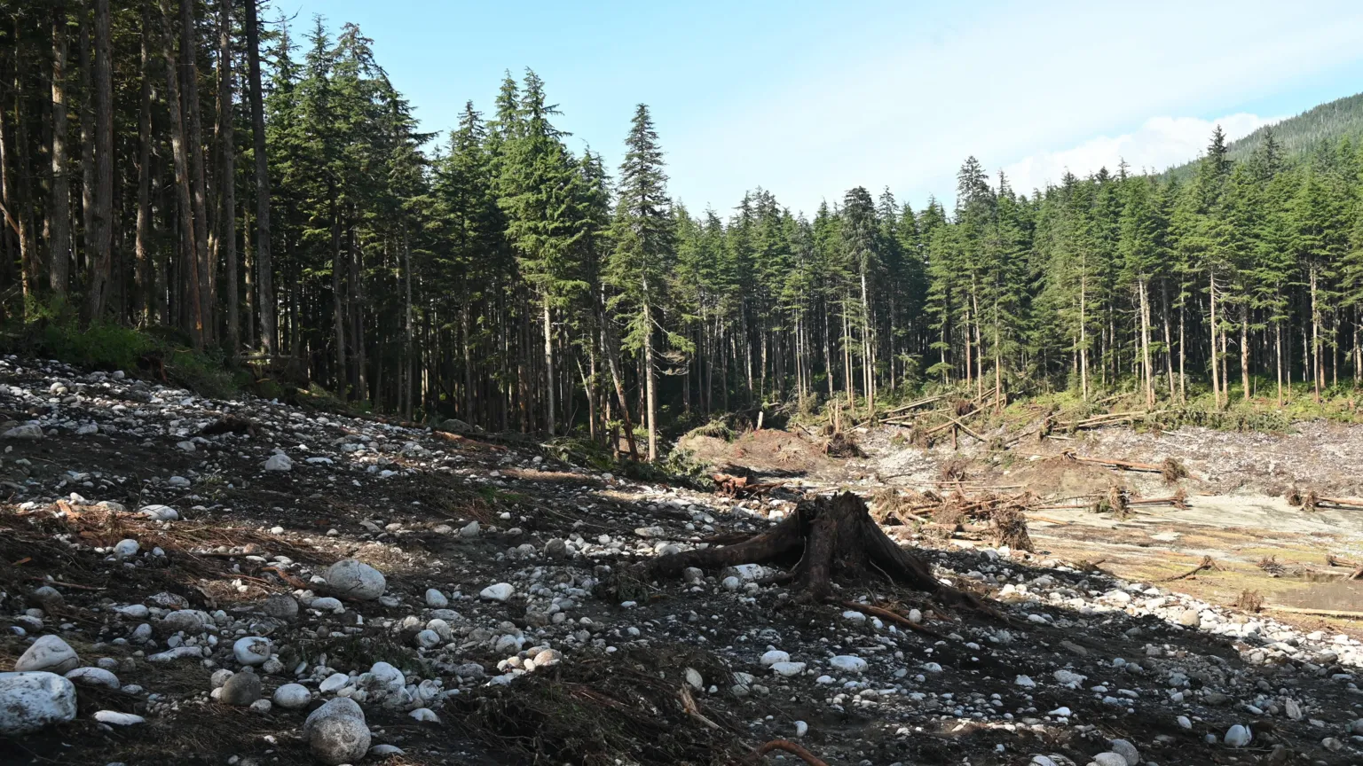
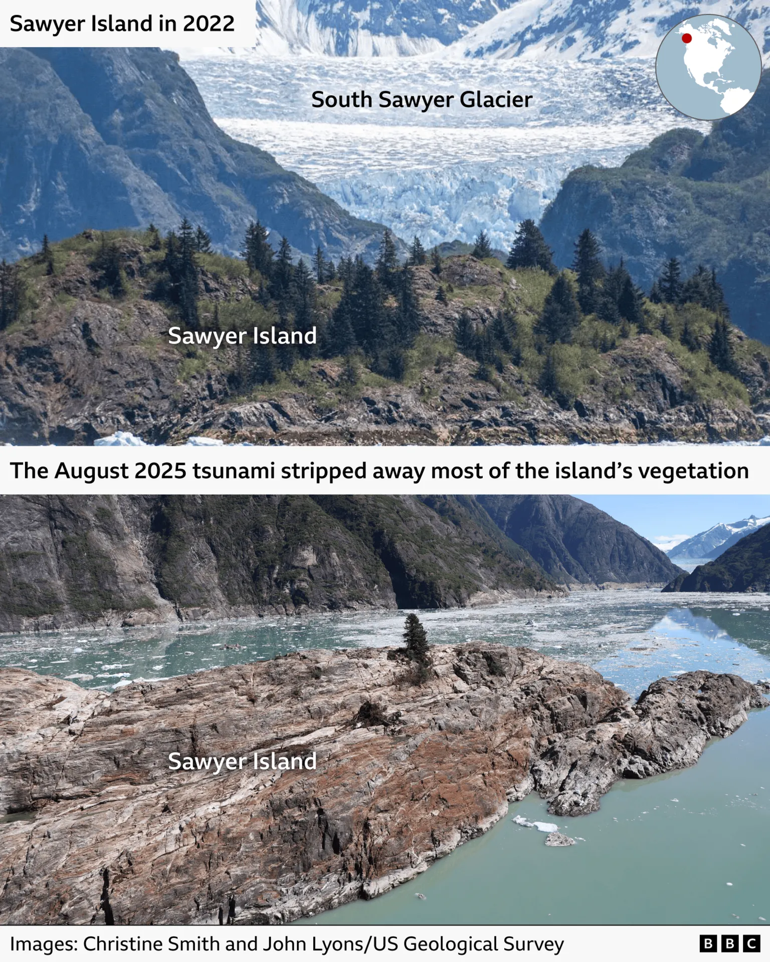
He observed broken trees scattered across the mountainside and thrown into the water, along with extensive areas of rock stripped of soil and vegetation.
Alaska's vulnerability to megatsunamis stems from its steep mountains, narrow fjords, and frequent seismic activity.
Climate Change and Glacier Melt Exacerbating Risks
New research published in Science indicates that glacier melt driven by climate change is intensifying such collapses.
The research team combined fieldwork, seismic data, and satellite imagery to reconstruct the sequence of events and estimate the wave's height.
Dr Stephen Hicks of University College London explained, "The glacier was previously helping to hold up this piece of rock, and so when the ice retreated, it exposed the bottom of the cliff face, allowing that rock material to suddenly collapse into the fjord."
Dr Hicks and his colleagues, who have studied tsunamis for decades, express concern about increasing risks.
"More people are now going to remote areas—often these tourist cruises are to see the natural beauty of the area and to learn more about climate change—but they are also dangerous places to be," he said.
Dr Higman concurs that the frequency of megatsunamis is rising significantly.
"At this point, I'm pretty confident that these are increasing not just a little bit, but increasing a lot," he stated. "Maybe in the order of 10 times as frequent as they were just a few decades ago."
Calls for Enhanced Monitoring and Safety Measures
Scientists are urging expanded monitoring of hazard-prone areas in Alaska vulnerable to megatsunamis.
In response to safety concerns, some cruise companies have announced plans to cease sending ships into Tracy Arm.


